First of all, a few important notes that you should definitely pay attention to.
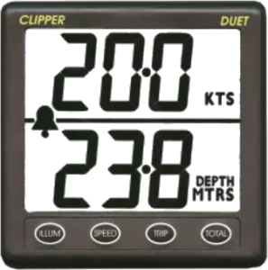
Fig.: NASA/Clipper Duet Sonar/Log
This article is about how to convert a NASA/Clipper Duet echo sounder/log so that the device outputs NMEA2000 data. This document is based on the DIY project by Sönke and was supplemented with some additional information. The NASA/Clipper Duet echo sounder/log is actually a device without a bus connection and works independently with two separate sensors.… Continue reading

Fig.: MDS dashboard
The MDS – Mmaritime Data Server was developed to store and display boat data.
Which data can be saved?
During development, emphasis was placed on having a system that was as flexible as possible. The MDS is currently prepared for temperatures, voltages, GPS values, pressure and humidity, digital values, etc. Further data can be created by defining sensor types in the database.... Continue reading
The flow of configuration for data integration in Ubidots looks like this:
- Login to Ubidots
- Create a plugin for webhook at Ubidots
- Set up webhook at TTN V3
- Checking the webhook functionality
Set up Ubidots login and plugin for webhook
In order to be able to transfer the received LoRa data from TTN to Ubidots, we need a plugin for data reception for a webhook Set up in Ubidots.… Continue reading
First of all, a few important notes that you should definitely pay attention to.
Raspberry Pi
The main hardware base for AVnav and OpenPlotter is the Raspberry Pi. It is a small computer in credit card format. It is available in several variants, although we are only concentrating on the Raspberry Pi 4B here. Of the older models, only the Raspberry Pi 3B is still interesting.… Continue reading
I don't own any of the devices and haven't tested any myself. The features listed here are manufacturer specifications. The beginning of the overview was created in sailing forum.
Unfortunately, posts there can no longer be edited at some point. Additions, improvements, comments, testimonials, etc. can be posted in the forum. I'll try to add them here.
Actisense W2K-1
- nmea2000 <-> nmea0183 Gateway: Wi-Fi only
- Gateway for additional sensors: no
- Own WLAN: yes
- Client in existing WLAN: yes
- Protocols: NMEA 0183, Raw CAN, NMEA 2000 over TCP & UDP
- Wi-Fi standard: IEEE 802.11 b/g/n
- Voyaga data recording: 8GB SD card included
- USB Interface: No.
...
Continue reading
First of all, a few important notes that you should definitely pay attention to.
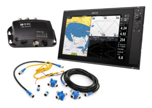
Fig.: B&G Zeuss with NMEA2000 connection technology (SVB)
Bus systems overview
In the marine sector, a large number of different bus systems are used for data transmission between sensors and display devices. Depending on the manufacturer, the bus systems use a different hardware basis. The systems are often not compatible with each other and require special converters or gateways for data exchange between the bus systems.… Continue reading
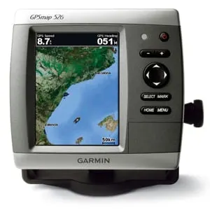
Garmin GPSmap526 (Garmin)
Garmin is one of the few commercial manufacturers that also allow the use of public free maps on their devices. This makes it possible to also provide older devices with up-to-date map material when support has expired. Garmin offers a variety of navigation devices that can be used on-road for street navigation as well as off-road for tracking.… Continue reading
Fig.: Mobile Atlas Creator (MOBAC)
mobile A.tlas Creator (MOBAC) is a Java open source program that provides offline maps for various navigation devices. As a source for an offline map, Mobile Atlas Creator can use a large number of different online maps, such as OpenStreetMap-based maps and other online map providers. In addition to pure navigation charts for vehicles on land, charts for watercraft are also offered.… Continue reading
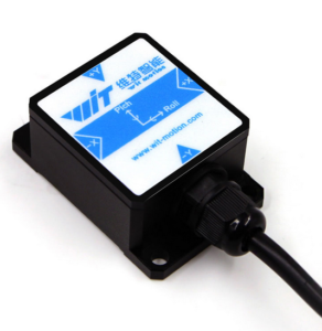
Fig.: HWT901B-RS232 9-axis sensor
The Chinese company WIT motion sells various sensor modules on the Internet. In addition to 3-axis, 6-axis and 9-axis modules, pure magnetometers are also offered in a wide variety of designs. A large number of interfaces are supported such as:
- TTL
- RS232
- Modbus
- Bluetooth
- WiFi
A particularly interesting sensor is the HWT901B-RS232. This is a 9-axis sensor as a military variant with the following properties:
- 3-axis acceleration sensor
- 3-axis gyrometer
- 3-axis magnetometer
- BMP280 environmental sensor (temperature, air pressure, humidity)
- 32Bit CPU for 9-axis sensor fusion
- Accuracy roll, pitch: 0.05°
- Accuracy heading: approx.
...
Continue reading
The idea of this AVnav plugin is to display an instrument that contains all the basic information needed for sailing. With the possibility of showing this display directly on the map at the boat position, the sailor has all the information at a glance. The laylines tell you the quickest bearing to a waypoint upwind, and when they are shown on the chart you can follow those lines.… Continue reading