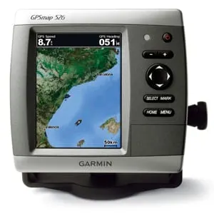
Garmin GPSmap526 (Garmin)
Garmin is one of the few commercial manufacturers that also allow the use of public free maps on their devices. This makes it possible to also provide older devices with up-to-date map material when support has expired. Garmin offers a variety of navigation devices that can be used on-road for street navigation as well as off-road for tracking. Some device series support marine applications, sometimes also in parallel operation with road navigation. In the following it will be shown how open source cards can be used in such devices for marine operation.
Table of contents
- 1 Supported Devices
- 2 map generation
- 2.1 Select map format
- 2.2 Choose base map
- 2.3 Select map area
- 2.4 generate map
- 2.5 Save map in device
- 2.6 Adapted maps for road navigation devices
- 2.7 Troubleshooting
- 2.7.1 The loaded map does not work in the device memory
- 2.7.2 Why can't I use several individual files at the same time?
- 2.7.3 Why can't I use the road map and the marine map at the same time?
- 2.7.4 Why is my device sluggish and maps have holes?
- 2.7.5 Why are no navaids displayed in road navigation devices?
- 2.7.6 How can I transfer nautical charts to a Garmin BlueChart G1 Stick?
- 2.7.7 Why aren't my maps showing from a Garmin BlueChart G1 Stick?
- 2.7.8 Can you also transfer nautical charts to a Garmin G-Chart Stick?
- 3 Further information
Supported Devices
Not all Garmin devices are suitable for marine use. In the linked list on Open Street Map some devices are listed. The list is not complete and only shows a few devices. One full list of supported marine plotters of the GPSmap series can be found at the link.
It is also possible to operate pure street navigation devices with open source marine charts:
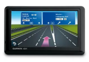
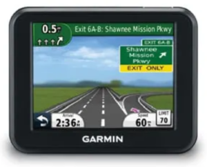
Fig.: Garmin Nüvi 1390 and Nüvi 30 (Garmin)
- Garmin Drive Series
- Garmin Nuvi series
With these devices, however, a limited map display is to be expected, since certain marine layers are not supported. In principle, the marine maps are more suitable than the road maps supplied. This is quite sufficient for simple indoor applications. There are some providers who offer specialized maps for these devices, in which the information from missing layers has been integrated into other layers. The big advantage of street navigation devices is that older 5″ models can be purchased quite cheaply in the used market and are suitable for operation in sunlight. In addition, they offer dual operation by selecting the respective card and can be used quite universally. The practical suction cup mount for the windscreen can be used just as well on the boat.
map generation
Map generation for marine applications is done via the website bbbikes.org. This is an online map service with which you can create any maps for Garmin and other devices yourself. The following maps can be generated via the map service:
- road maps
- bike maps
- hiking maps
- elevation maps
- naval charts
Open source maps serve as the database OpenStreetMap, covering all world regions. The base maps can be combined with different layers for the respective applications.
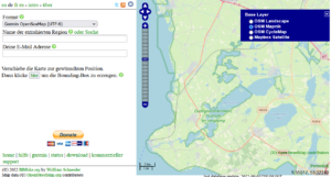
Select map format
First up is the website bbbikes.org called and under format the sea map format Garmin OpenSeaMap (UTF8) selected.
Choose base map
The next step is to select the base map that is to serve as the background. To do this, click on the small plus sign on the right-hand side and select OSM Mapnik out.
Select map area
Now the map area can be selected. First is about the button here provided and adjusted a rectangle. In a further step about Add points to the polygon changed the rectangle so that it covers all areas that you want to drive on.
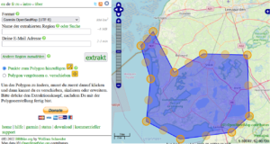
Notice: Be as economical as possible with the area selection and only select areas that really interest you. A rectangular selection should be avoided, since unnecessary information is often included in the map that you ultimately do not need for navigation. You save valuable storage space and the device has to process less data and therefore runs much more smoothly.
generate map
Before you can create the map, you still have to assign a name for the map and enter your e-mail. After that, the map generation can be started via the button extract be triggered. You will then receive information about the duration of the map creation and will be informed of the completion with an email and a download link. Please help keep the free service going by making a reasonable donation.
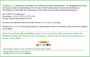
The download link leads to a ZIP file that you can download to your computer.
Save map in device
The easiest way to transfer the downloaded maps is via the USB socket on the Garmin device. This mainly affects road navigation devices. Follow these steps:
- Connect the Garmin device to the computer and wait until the drives of the Garmin device are visible in the file manager
- zip file*.zip unpack
- file gmapsupp.img into existing directory xxx:\Garmins copy
- Disconnect USB connection (device then restarts)
- Select loaded map
- Road Navigation Devices: Under Tools -> Settings -> Map -> About select (deselect road map)
- Marine Navigators: See Chart Settings in the manual
With some road navigation devices, the map can be loaded into the internal memory, but is not available there for selection. The cards are then integrated into the device via an SD card. The SD card is mainly used in almost all marine navigation devices. Then proceed as follows:
- Format SD card with Fat32 (max. 32 GB)
- directory Garmin in the root directory of the SD card
- zip file*.zip unpack
- file gmapsupp.img into existing directory xxx:\Garmins copy to SD card
- Insert the SD card into the Garmin device and start the device
- Select loaded map
- Road Navigation Devices: Under Tools -> Settings -> Map -> About select (deselect road map)
- Marine Navigators: See Chart Settings in the manual
Switching the map may be slightly different on some Garmin devices due to the different menu structure. In general, a configuration page can be found under the Map section, in which the settings can be made. Marine maps and road maps can also be used simultaneously on some devices. However, this loads the CPU significantly more due to the simultaneous processing of several maps.
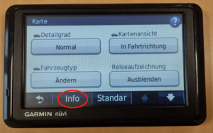
Fig.: Map configuration page
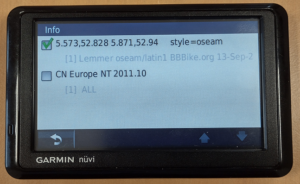
Fig.: Map selection with OSM map (above)
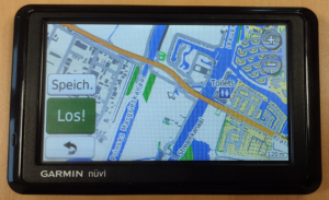
Fig.: OSM map medium zoom level Garmin Nüvi 1390 (road navigation device)
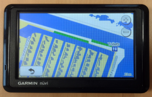
Fig.: OSM map highest zoom level
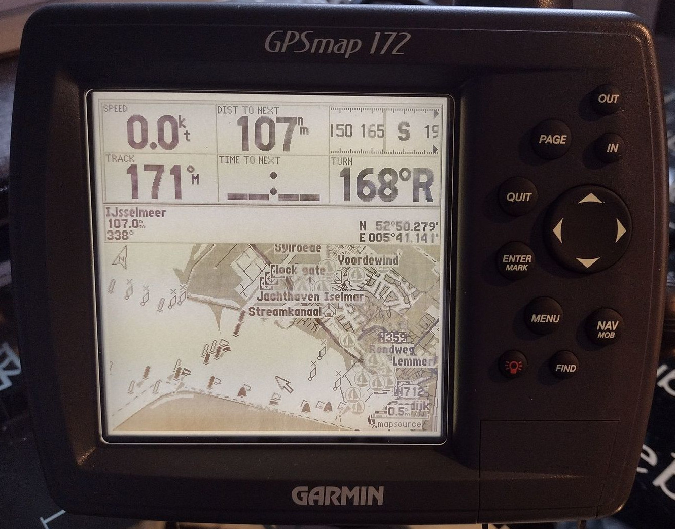
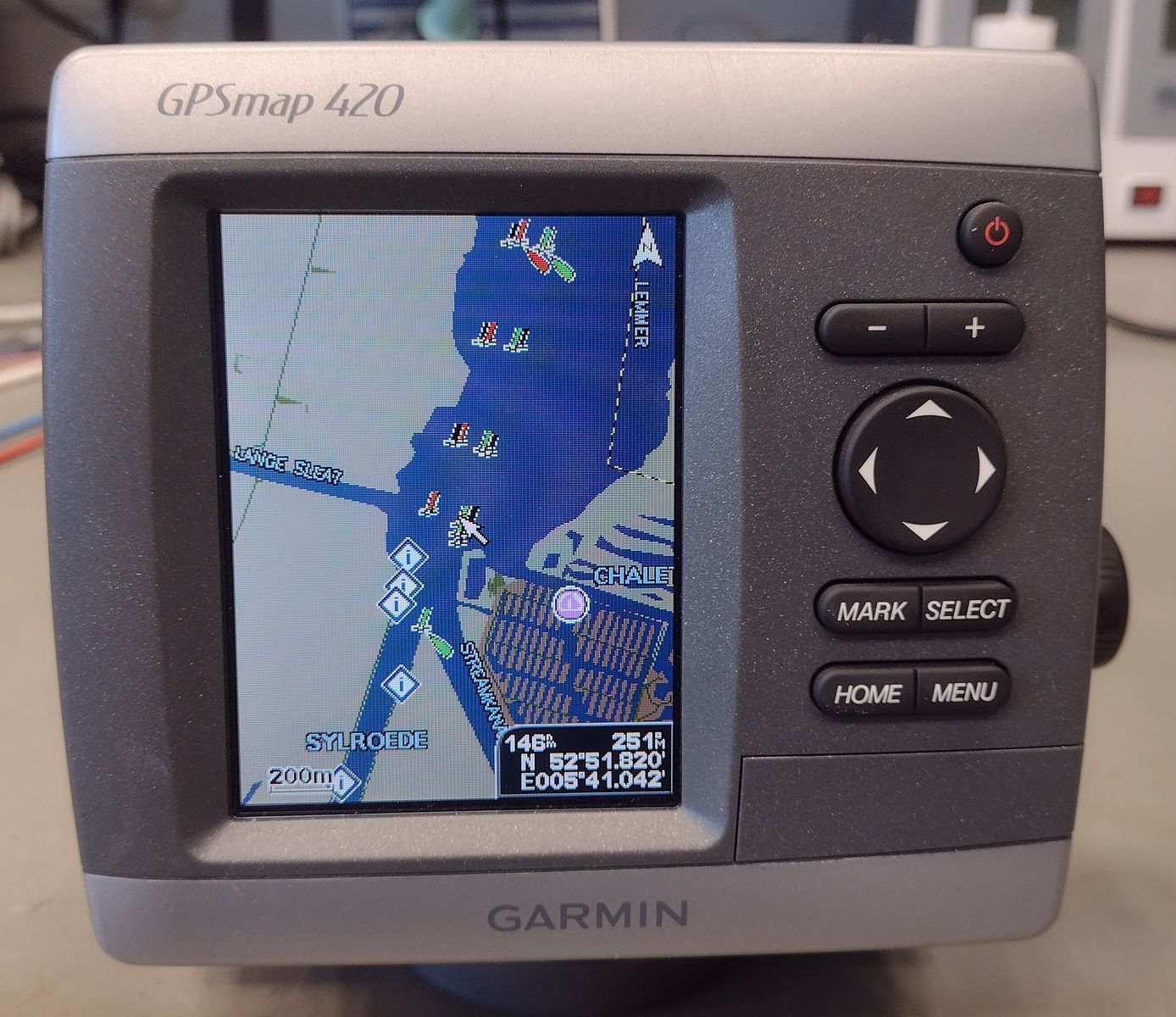
Fig.: OSM map on GPSmap 420 (Marine compatible Garmin device)
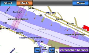
Fig.: OSM map on GPSmap 620 (Marine compatible Garmin device)
As can be seen in the last picture, the marine maps are displayed in more detail and better on marine devices than on road navigation devices.
On the website waterways.cz ready-made marine charts for the European waterways can be downloaded. Then you save yourself the card creation.
For road navigation devices, two specially created maps are provided here that have moved some information to other layers:
- gmapsupp.img (for older devices)
- gmapsupp2.img (for newer devices)
For some Garmin devices that can also display KML data, there are special ones KML overlays that can be integrated.
Troubleshooting
The loaded map does not work in the device memory
If the downloaded map does not work directly in the device memory and is not selectable, try the map on an SD card in the directory \ Garmin save and use them in the SD card slot of the device. On older Garmin devices, only maps with the file name Gmapsupp.img accepted. Then change the file name.
If marine charts are over 2GB, some devices will not be able to display them. Then reduce the map sections.
In older devices, only SD cards (SD 1.0 and SD 1.1) up to 2 GB can be used. SDHD, SDXC or SDUC are unsuitable in these devices.
Some current marine devices of the latest generation no longer offer the option of displaying old maps (Bluechart G1). OSM maps can no longer be used on these devices.
Why can't I use several individual files at the same time?
Older devices only accept a single map file in the directory \Garmin. If you want to use several different map areas at the same time, you can use the gmaptool combine into one file. Newer devices, on the other hand, can handle multiple files. Then use added numbers in the filename: Gmapsuppx.img
Why can't I use the road map and the marine map at the same time?
Some simple Garmin devices with a weak processor only allow you to select one map for performance reasons. With more powerful devices, several cards can be selected at the same time.
Why is my device sluggish and maps have holes?
Depending on the device model, very large maps (1-2 GB and above) may exceed the available memory, resulting in only partial display of the map. The large amount of data puts excessive strain on the processor. Divide the map into smaller sections using multiple files. This reduces the amount of data the processor has to handle, making the device respond more smoothly. Reduce the map area to only the area you actually use for navigation. The polygon function allows you to precisely select only areas containing water and their surroundings.
Road navigation devices do not use the navaid layers. Therefore, these characters cannot be displayed on the map. There is one map service which puts some navaids on layers that can also be displayed by road navigation devices. Alternatively, they switch to a Garmin model that can also display the marine layer.
How can I transfer nautical charts to a Garmin BlueChart G1 Stick?
In order to be able to transfer maps to a Garmin BlueChart G1 Stick (Micro G-Chart Small), you need the Garmin USB Data Card Programmer and the Garmin software MapSource. However, the USB Data Card Programmer no longer works from Win7 because the drivers are too old. The USB drivers can only be installed under WinXP or WinVista. How to install the USB driver is in this installation instruction described. However, only writable BlueChart G1 sticks up to 256 MB can be written.
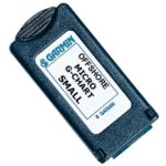
Fig.: Garmin BlueChart G1 Stick
If you are looking for pre-rendered OpenSeaMap charts for integration in MapSource, you should these sources to use. The zip files with the extension xxx_ms.zip have been specially created for MapSource and contain a batch file for installing the maps. But the file still has an error. In line
reg ADD %KEY%\Families\openseamap /v ID /t REG_BINARY /d 3032 /f
value 3032 must be replaced with d80b.
reg ADD %KEY%\Families\openseamap /v ID /t REG_BINARY /d d80b / f
Only then will the OpenSeaMap charts work under the last current MapSource version V6.163.
Why aren't my maps showing from a Garmin BlueChart G1 Stick?
Maps for a Garmin BlueChart G1 stick may only be created up to a size of 4MB, as the old Garmin devices do not have enough memory. Maps larger than 4MB are not displayed. If you want to save a larger area of the lake as a map, you have to break it down into many small sub-maps. Depending on the level of detail in the map information, the map sections of the partial maps can vary in size.
Can you also transfer nautical charts to a Garmin G-Chart Stick?
Nautical charts cannot be transferred to a Garmin G-Chart Stick. These sticks are read-only sticks. A Garmin G-Chart Stick is slightly larger than a Garmin BlueChart G1 Stick and is often confused with it. Both sticks are incompatible with each other.
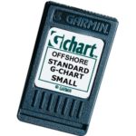
Fig.: Micro G-Chart Small (BlueChart) and Standard G-Chart Small
Further information
https://www.bootstechnik.de/2017/05/24/seekarten/
https://wiki.openstreetmap.org/wiki/DE:OpenSeaMap_and_Garmin_nautical_chart_plotter#Ger%C3%A4teliste
https://www.gmaptool.eu/en/content/gmaptool
https://www.navigation-professionell.de/karten-installation-osm-garmin-outdoor/