First of all, a few important notes that you should definitely pay attention to.
Raspberry Pi
The main hardware base for AVnav and OpenPlotter is the Raspberry Pi. It is a small computer in credit card format. It is available in several variants, although we are only concentrating on the Raspberry Pi 4B here. Of the older models, only the Raspberry Pi 3B is still interesting.… Continue reading
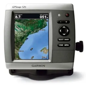
Garmin GPSmap526 (Garmin)
Garmin is one of the few commercial manufacturers that also allow the use of public free maps on their devices. This makes it possible to also provide older devices with up-to-date map material when support has expired. Garmin offers a variety of navigation devices that can be used on-road for street navigation as well as off-road for tracking.… Continue reading
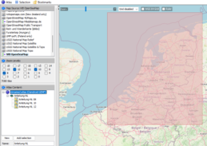
Fig.: Mobile Atlas Creator (MOBAC)
mobile A.tlas Creator (MOBAC) is a Java open source program that provides offline maps for various navigation devices. As a source for an offline map, Mobile Atlas Creator can use a large number of different online maps, such as OpenStreetMap-based maps and other online map providers. In addition to pure navigation charts for vehicles on land, charts for watercraft are also offered.… Continue reading
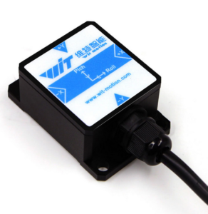
Fig.: HWT901B-RS232 9-axis sensor
The Chinese company WIT motion sells various sensor modules on the Internet. In addition to 3-axis, 6-axis and 9-axis modules, pure magnetometers are also offered in a wide variety of designs. A large number of interfaces are supported such as:
- TTL
- RS232
- Modbus
- Bluetooth
- WiFi
A particularly interesting sensor is the HWT901B-RS232. This is a 9-axis sensor as a military variant with the following properties:
- 3-axis acceleration sensor
- 3-axis gyrometer
- 3-axis magnetometer
- BMP280 environmental sensor (temperature, air pressure, humidity)
- 32Bit CPU for 9-axis sensor fusion
- Accuracy roll, pitch: 0.05°
- Accuracy heading: approx.
...
Continue reading
The idea of this AVnav plugin is to display an instrument that contains all the basic information needed for sailing. With the possibility of showing this display directly on the map at the boat position, the sailor has all the information at a glance. The laylines tell you the quickest bearing to a waypoint upwind, and when they are shown on the chart you can follow those lines.… Continue reading
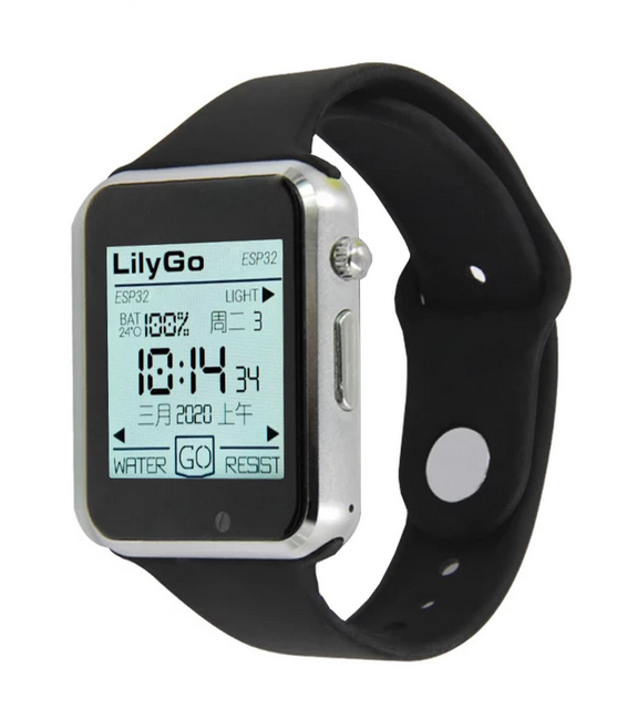
Fig. Lilygo T-Watch 2020 (Lilygo)
Jan Dytrych has started a software project to be able to display data from SignalK and receive alarms with a smart watch. Not just any common clock under Android is used as a smart watch. He uses the smart watch Liligo T Watch 2020. The special feature of this clock is that it has an ESP32 installed as a processor and can be controlled via the Arduino IDE or… Continue reading
why
I've always found the idea of not only showing the course on my plotter when the boat is moving, but also when it's bobbing along quietly, I've always found it exciting.
After searching the I-Net for different manufacturers, it quickly became clear that I might not need an e-compass on board at current prices.… Continue reading
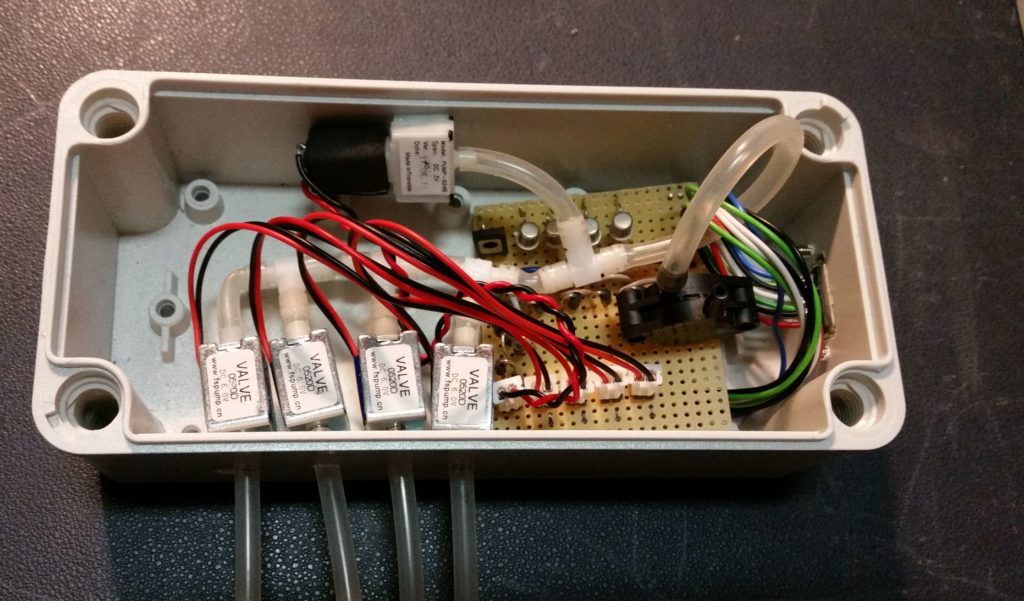
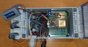
Fig. Control box with pump, pressure sensor and valves
In the Facebook group Raspberry Pi for Boats I saw a cool solution for a level measurement. Erik from Finland constructed a monitor for 4 tanks with an air pressure sensor. The functional principle is based on the displacement of liquids in a measuring tube. A corresponding air pressure then builds up in the measuring tube, which is proportional to the filling level.… Continue reading
First of all, a few important notes that you should definitely pay attention to.
Disclaimer: The descriptions of the wiring and the pin assignments correspond to what I found in my boat. Therefore, if you want to rebuild the interface, you have to make sure that the wiring and pin assignments are identical on your own boat or adapt the interface accordingly. The entire description of this solution is in an experimental state and comes without any warranty.... Continue reading
First of all, a few important notes that you should definitely pay attention to.
Route planner for European inland waterways
| From the North Sea to the Black Sea, through Finland via the Saimaa Lakes, back from the Mediterranean to the Baltic Sea?
The open-source / open-data project brouter.grade.de has started the test phase!
The whole story https://bastelbude.grade.de |
|
...
Continue reading