RayNet is an Ethernet protocol and connector standard developed by Raymarine to connect high data volume systems. This includes systems such as plotters, cameras, radar devices, controllers for autopilots and some other systems. Raynet uses an Ethernet connection with a transmission rate of 10/100/1000 Mbit/s, which enables fast transmission of data and high-resolution video transmission in real time.
Category: openSource
SeaTalk NG
Raymarine SeaTalk NG
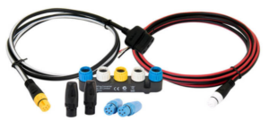
Fig.: SeaTalk NG connection technology
With SeaTalk NG there is a more powerful successor to SeaTalk, which is based on the CAN bus and has limited compatibility with NMEA2000. With the fairly clear and color-coded connection technology of SeaTalk NG, Raymarine has managed to provide backwards compatibility with SeaTalk, which also supports older devices. The disadvantage, however, is the high price for the proprietary connection technology.… Continue reading
Raymarine SeaTalk
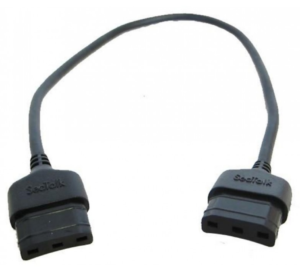
Fig.: SeaTalk connection technology
SeaTalk is a Raymarine proprietary serial network protocol developed in the 1980's and used for the transmission of navigation data and other information on boats. The data is transmitted as compact binary data. SeaTalk uses a single wire connection as the data line for serial data transmission, meaning they are both sent and received bit by bit over a single wire.… Continue reading
OneNet

NMEA OneNet is a transmission method based on Ethernet. With NMEA OneNet, as the name suggests, an attempt is made to bundle a wide variety of transmission methods such as NMEA0183 and NMEA2000 in one protocol and thus maintain compatibility with old transmission methods. In addition, new protocols are added with which large amounts of data such as image and map transmission are also possible.
NMEA2000
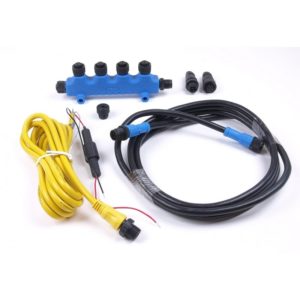
Fig.: NMEA2000 connection technology (Busse yacht shop)
NMEA2000 (National Marine Electronics Association 2000) is a bus system for communication in boats. It was designed to provide a uniform interface for transferring data from electronic devices on boats.
operating principle
NMEA2000 is a bus system designed to transmit data between electronic devices on boats.… Continue reading
NMEA0183
NMEA 0183 is a marine serial communications standard. It defines a format for the transmission of GPS information, speed and course data, and other navigation data between navigation devices and other electronic devices on boats.
Benefits of NMEA 0183:
- Common: NMEA 0183 is a common standard supported by many legacy devices
- Ease of implementation: It is easy to develop a device for NMEA 0183 as there are simple protocols and a well-documented specification.
NMEA2000 for NASA / CLIPPER Duet sonar/log
First of all, a few important notes that you should definitely pay attention to.
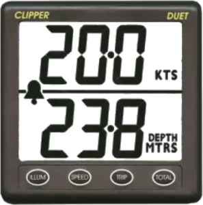
Fig.: NASA/Clipper Duet Sonar/Log
This article is about how to convert a NASA/Clipper Duet echo sounder/log so that the device outputs NMEA2000 data. This document is based on the DIY project by Sönke and was supplemented with some additional information. The NASA/Clipper Duet echo sounder/log is actually a device without a bus connection and works independently with two separate sensors.… Continue reading
Create maps for Garmin devices
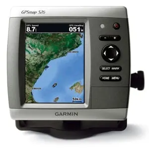
Garmin GPSmap526 (Garmin)
Garmin is one of the few commercial manufacturers that also allow the use of public free maps on their devices. This makes it possible to also provide older devices with up-to-date map material when support has expired. Garmin offers a variety of navigation devices that can be used on-road for street navigation as well as off-road for tracking.… Continue reading
Create offline maps with MOBAC
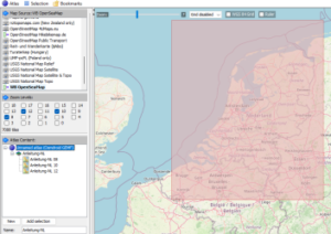
Fig.: Mobile Atlas Creator (MOBAC)
mobile A.tlas Creator (MOBAC) is a Java open source program that provides offline maps for various navigation devices. As a source for an offline map, Mobile Atlas Creator can use a large number of different online maps, such as OpenStreetMap-based maps and other online map providers. In addition to pure navigation charts for vehicles on land, charts for watercraft are also offered.… Continue reading
Magnetic compass for SignalK
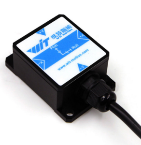
Fig.: HWT901B-RS232 9-axis sensor
The Chinese company WIT motion sells various sensor modules on the Internet. In addition to 3-axis, 6-axis and 9-axis modules, pure magnetometers are also offered in a wide variety of designs. A large number of interfaces are supported such as:
- TTL
- RS232
- Modbus
- Bluetooth
- WiFi
A particularly interesting sensor is the HWT901B-RS232. This is a 9-axis sensor as a military variant with the following properties:
- 3-axis acceleration sensor
- 3-axis gyrometer
- 3-axis magnetometer
- BMP280 environmental sensor (temperature, air pressure, humidity)
- 32Bit CPU for 9-axis sensor fusion
- Accuracy roll, pitch: 0.05°
- Accuracy heading: approx.