https://www.segeln-forum.de/thread/78183-i2c-io-module-f%C3%BCr-signalk-und-zur-bootsautomation/?postID=2231713#post2231713
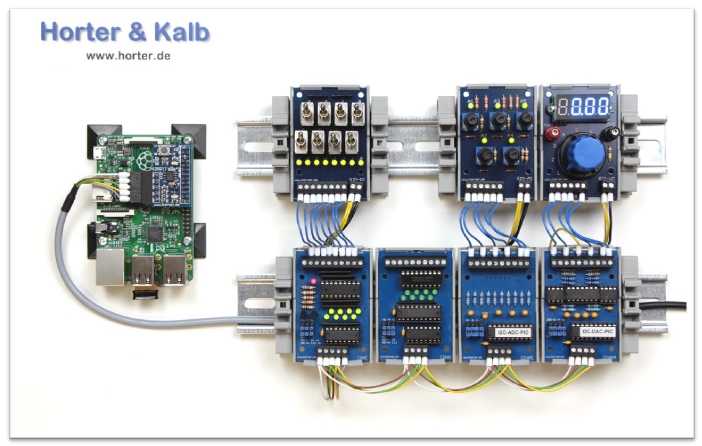
The I2CModules of the Horter company (LxW 65x45mm) can be used for boat automation because they can be connected to any microcontroller and the Rasperry Pi. The I2C bus is actually intended for communication between ICs on a circuit board. But there are also numerous Extensions with which the bus signals can be amplified and electrically isolated so that longer distances of up to 50m can be bridged with shielded cables.… Continue reading
https://www.segeln-forum.de/thread/76840-hubkielsensor-diy/
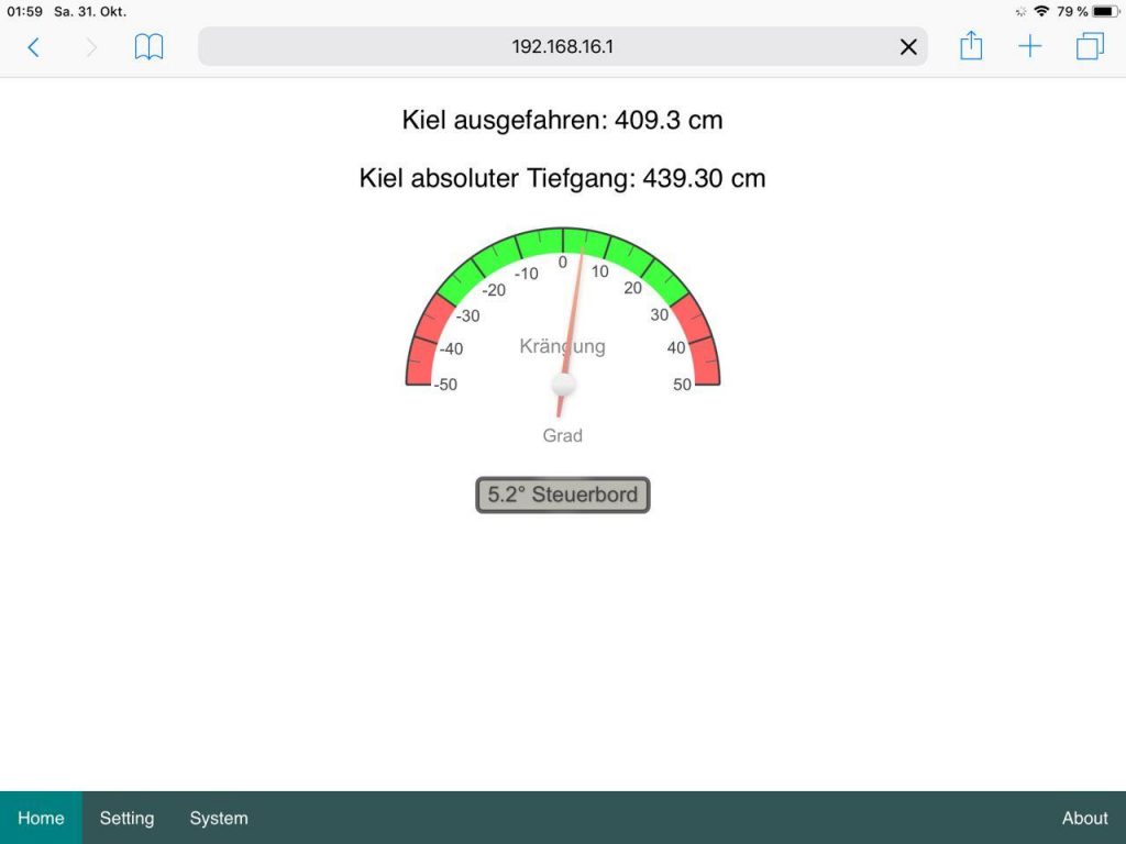
Gerry from the Sailing Forums built a keel sensor to show the extended depth of a liftable keel. In addition to the keel depth, the heel is also displayed. The keel depth is measured using an ultrasonic sensor. For this purpose, the sensor is mounted inside the keel box and looks down on the lowered keel. The measurement data can be transmitted via WLAN, for example… Continue reading
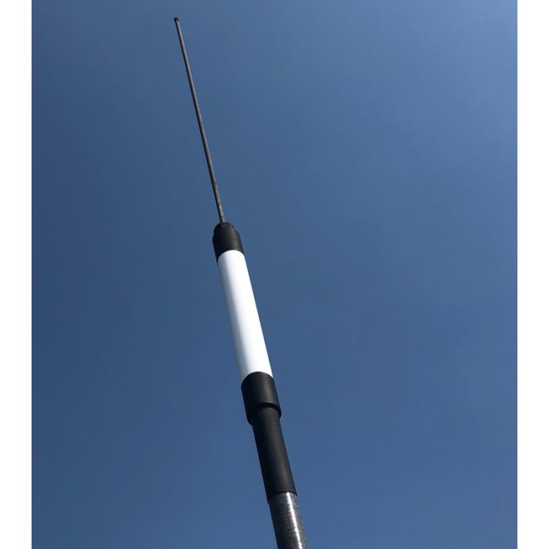
Fig.MAIANA AIS transponder transmitting and receiving part with fixed antenna (Open Marine)
Peter Antypas self-built an AIS class B receiver / transmitter and presented it on Github:
https://github.com/peterantypas/ais_transponder
functionality
The device combines the following functions:
- AIS class B receiver / transmitter
- 161.975 MHz (channel 87B), 162.025 MHz (channel 88B)
- 2W transmission power
- Silicon Labs 4463 transceiver ICs
- STM32L412 microcontroller 80MHz
- GPS Quectel L70R module, ceramic SMD antenna (for your own location transmission)
- 3.3V UART output at 38.4Kbps
- NMEA0183 data telegrams
- Update rate 1 Hz
- 12V / 30 mA
- Disclosure of construction documents and the Software on Github
The AIS transponder consists of a transmitting and receiving part with a permanently attached antenna, which is connected to an adapter box via a shielded cable.… Continue reading
First of all, a few important notes that you should definitely pay attention to.
https://www.segeln-forum.de/thread/74840-lora-monitoring-und-alarmserver/
https://github.com/norbert-walter/LoRa-Boat-Monitor
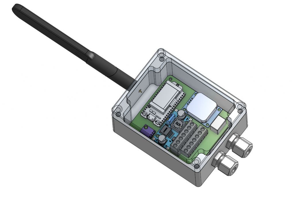
The LoRa boat monitor is used to monitor the boat when you are away. Various measured values are transmitted continuously at freely adjustable time intervals via LoRa radio technology (long range) to the LoRaWAN forwarded and recorded. The data is sent from the TTN server V3 (The Thinks Network) received and cached in Ireland for Europe and then to Ubidots forwarded as web frontend.… Continue reading
First, a few important notes that you should definitely observe.

- completely web based navigation software for boats
- raster chart display (tile based) like Google Maps
- runs as server on a raspi
- also available as standalone android app
- features
- use small devices like tablets or cell phones for navigation
- optimized for devices starting at 7"
- perfectly usable on 10" devices see here
- attach your sensors via USB, serial, bluetooth, TCP - also possible on android (GPS, wind, speed, depth,AIS)
- using NMEA0183
- integrated NMEA multiplexer and WLAN gateway
- usable for NMEA2000 with canboat
- track logging
- route planning
- using raster charts (BSB,NV, downloaded charts from mobile atlas creator)
- simple installation
- small, low power consumption
- display adaptable(sizes via settings, free configuration what to display where)
- can be extended and adapted (server plugins, css adaption, java script for own displays)
Left
Different Set Ups
- “Classic” setup – Raspberry Pi installed in the boat, plus one or more tablets for display and operation.
...
Continue reading
First of all, a few important notes that you should definitely pay attention to.
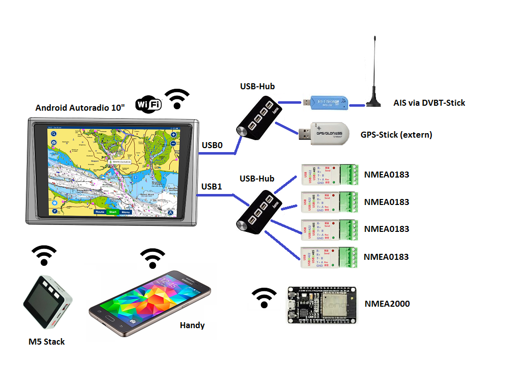
- Basis 2 DIN Android car radio
- Touch-capable 7” – 10” display, 1024 x 600 pixels, approx. 400 nits
- Touch function keys
- Cortex A7 QuadCore ARM processor, 1.2 GHz
- Depending on the model, Android 8, 9 or 10
- Depending on the model, 1… 4 GB RAM
- 16/32 GB ROM depending on the model
- Powerful wired GPS included
- Bluetooth, WiFi 802.11b / g / n, 2.4 GHz
- Integrated CAN bus (steering wheel remote control)
- 12V supply
- 10… 15 W in active operation
- 0.5 W in standby
- 3 s wake-up time from standby
- 2x USB 2.0 (ext.
...
Continue reading
THE free and open source chart plotter: opencpn.org

- numerous chart formats supported
- individual user interface
- AIS collision alert
- integration of weather and current gribs
- NMEA0183 interface (SignalK support under development)
- tactics plugIn
- …
Official vector charts (iENCs) are available free of charge for inland waterways in Europe and the USA. Offshore charts (oeENCs) made available via o-charts.org to be acquired.… Continue reading
First of all, a few important notes that you should definitely pay attention to.
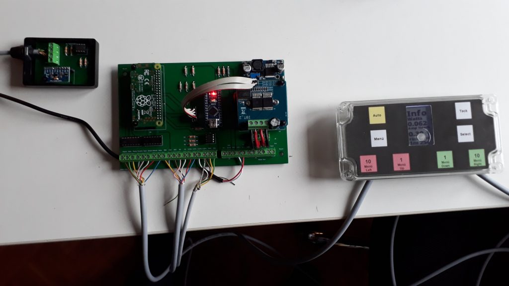
Fig .: PyPilot components
Video: PyPilot in action
pyPilot is an open-source autopilot (hard- and software) written by Sean D'Epagnier.
Features:
- automatic sensor calibration
- steering modes
- compass
- GPS
- apparent wind
- true wind
- signalK und nmea0183 communication protocol
- OpenCPN integration
- low power consumption
user experience: http://phoenixketch.blogspot.com
Video: https://youtu.be/IMqUmcTbQOE
IBT-2 based motor controller: https://hackaday.io/project/168592-opencpn-chart-plotter-w-autopilot-and-waypoints
Andreas from the Segeln-Forum has created a hardware basis for replicating the pyPilot.… Continue reading


