First of all, a few important notes that you should definitely pay attention to.
GaladrielMap is a web-based navigation software from Vladimir Kalachikhin. The name of the software is named after his boat. The software is based on a large number of PHP scripts that generate websites and are published via a web server. The websites can be displayed on any end device such as mobile phone, tablet and laptop. Only a web browser is required on the end device. The output of the navigation software can be displayed under all common operating systems. GaladrielMap has the following features:
- Display of nautical charts online and offline via cache (OpenSeaMap, OpenTopoMap)
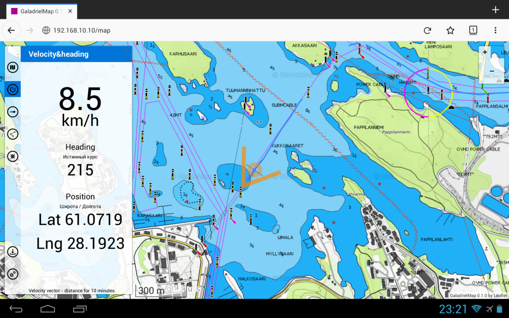
- Display of your own position via GPS data provided by gpsd
- Creation of your own routes
- Creation of driven routes or POIs as gpx, kml and csv
- Display of AIS information
- Share your AIS position with others
- Display of the weather forecast via Thomas Krüger Weather Service
- Dashboard for displaying navigation data as numerical values
There is one for GaladrielMap virtual machine for Virtual Box to test the software functionality. There is also a executable image for a RaspberryPi with which a finished server with all necessary components can be set up. To do this, the image only needs to be saved on a 32GB SD card and then plugged into the RaspberryPi. In addition to the RaspberryPi, there is also the option of running the navigation software on a modified WLAN router with OpenWRT.
A description and precise installation instructions can be found on Github: https://vladimirkalachikhin.github.io/Galadriel-map/
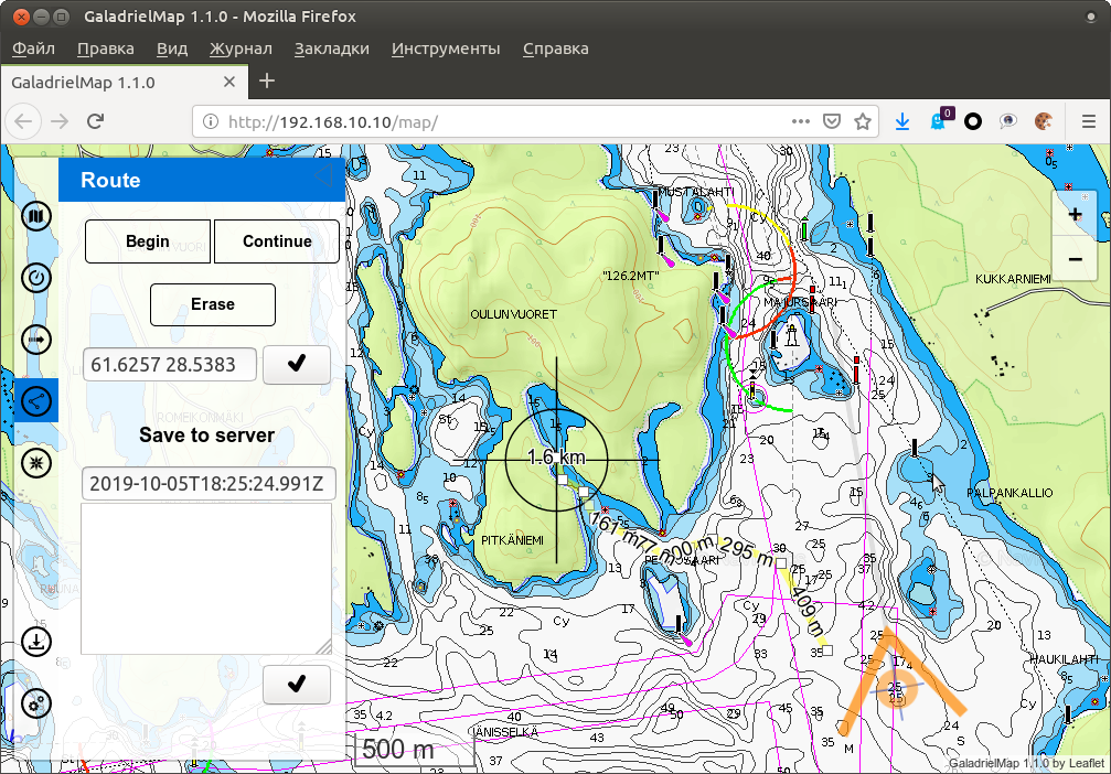
Route creation
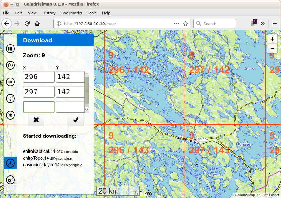
Generate offline nautical charts
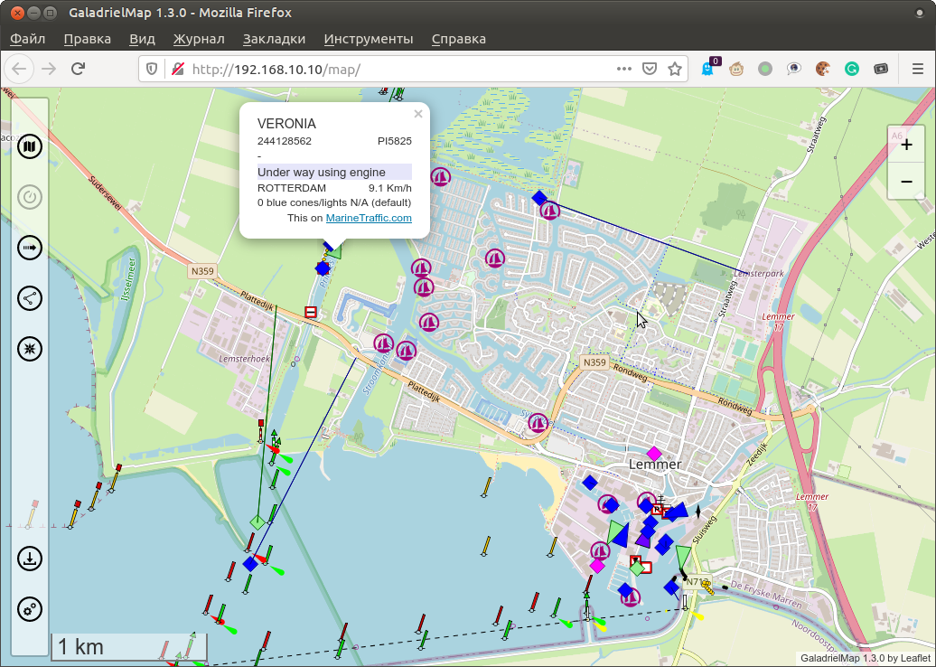
Display of AIS information
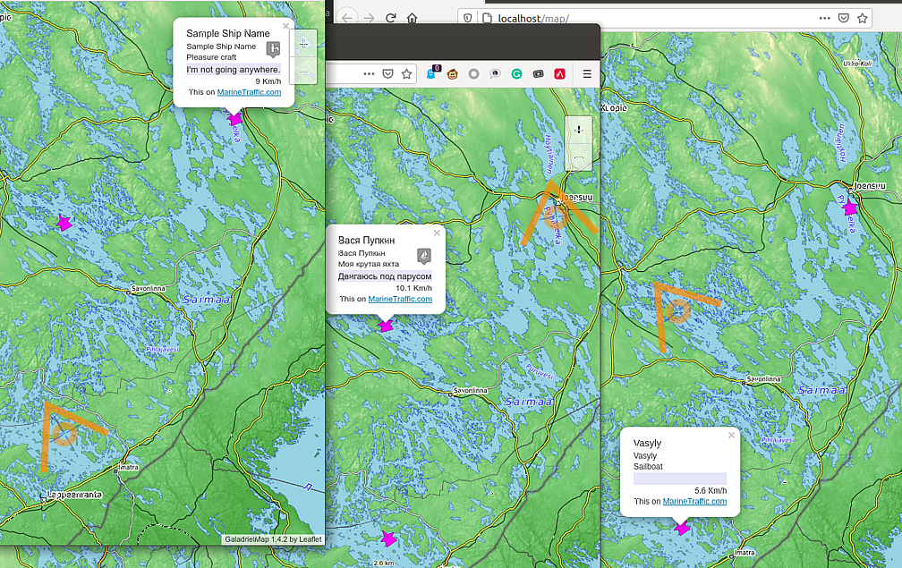
Share your own location with others
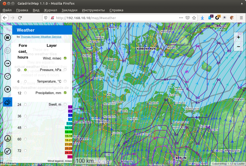
Display of weather information
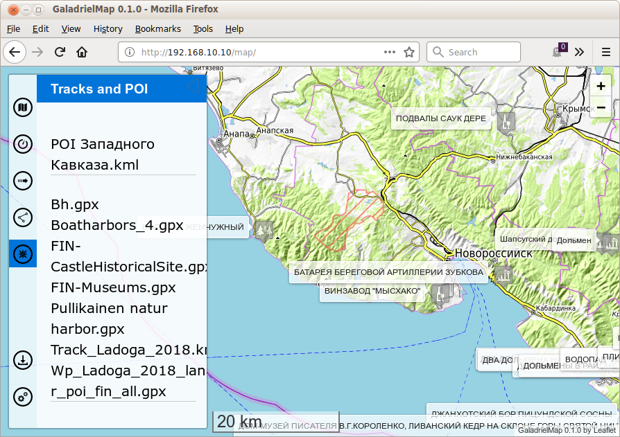
Saving tracks
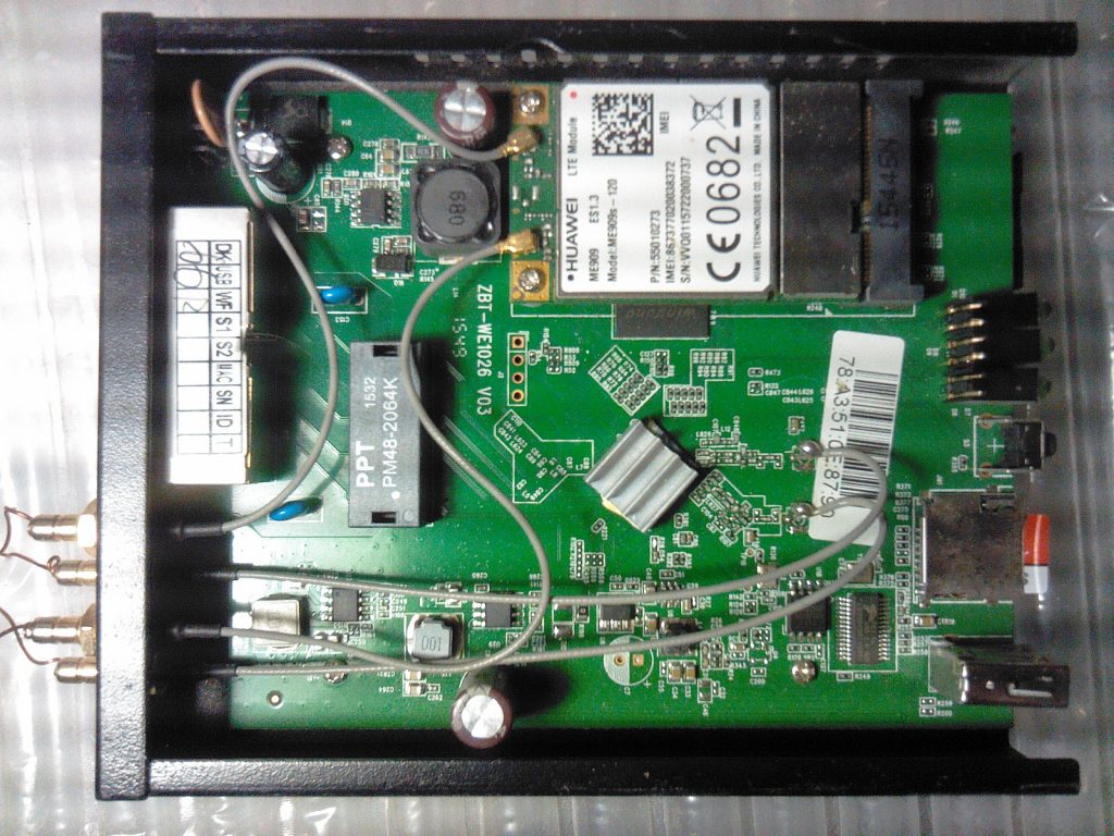
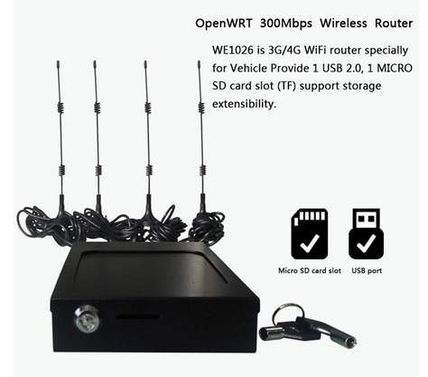
Car WiFi router MT7620A 300Mbps and 3G / 4G / LTE Internet gateway with OpenWRT firmware and integrated GaladrielMap
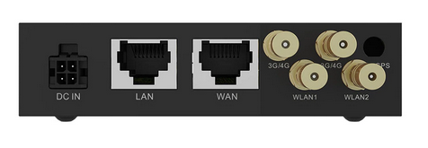
Car WiFi router front view
Car WLAN router in lockable installation frame