First of all, a few important notes that you should definitely pay attention to.
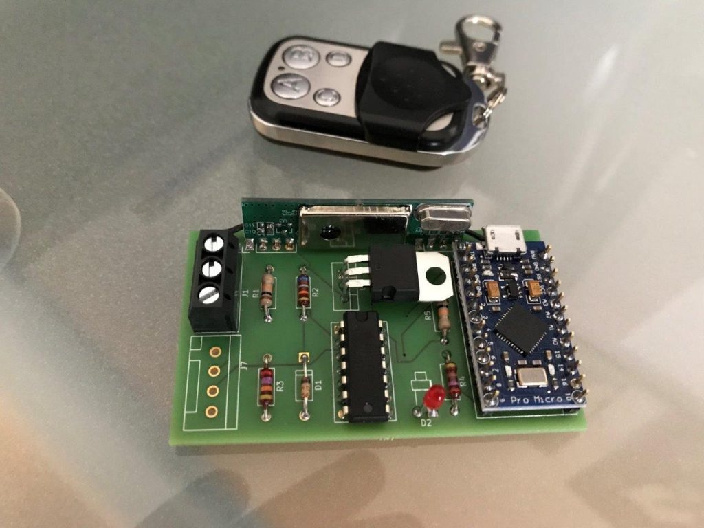
- OpenSource Seatalk radio remote control for Raymarine autopilots
- Basis: Arduino ProMicro and 433MHz radio module
- Simple 433MHz 4-channel radio transmitter can be used
- Plus / minus 1 and plus / minus 10 degree steps
- Can also be combined with an OLED display (e.g. for wind display)
- Simple solderability through the use of conventional components in through-hole technology
- Programming with Arduino IDE
- Costs (board and components): approx.
...
Continue reading
First of all, a few important notes that you should definitely pay attention to.
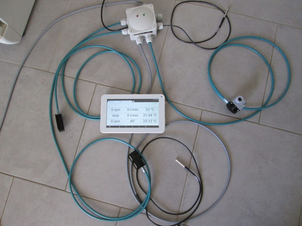
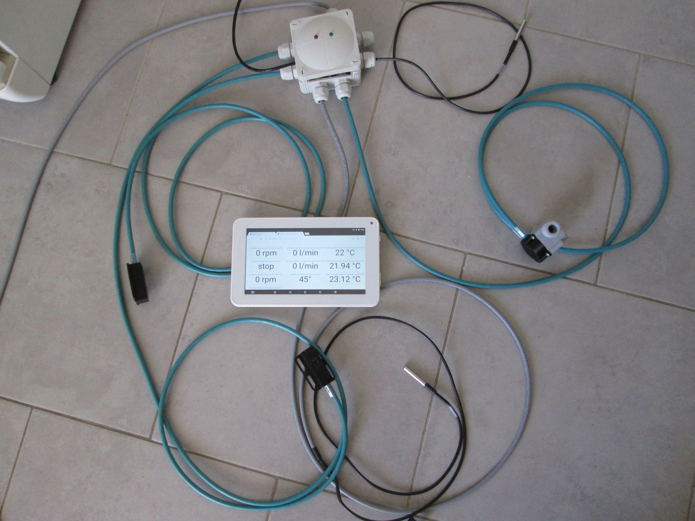
- Retrofitting for all motor types, as independent sensors are used
- Use of cheap sensors
- Measurements of various engine parameters
- Flow rate cooling water (impulse, YF-S201B)
- Temperature cooling circuits (1Wire, DS18B20)
- Engine compartment temperature (1Wire, DS18B20)
- Engine RPM (Pulse, GP2A26 Sharp)
- Output Shaft Speed (Pulse, GP2A26 Sharp)
- Tank level via pressure sensor
- Engine operating hours (via speed detection)
- Power supply via 12V on-board network
- Data processing with ESP8266
- Data transfer via WLAN
- Data protocol NMEA0183, partly with customer-specific telegrams
- Data display via OpenPlotter
- Simple web front end for operation and display via mobile phone
- Waterproof case
- Installation location in the engine compartment for short cables
- All sensors connected by cable
- Price less than 120 euros for material
- Current Circuit diagram
- Board is with Aisler orderable
- Current software: Source code, Binary file
https://www.segeln-forum.de/thread/71890-motormanagement-diy/... Continue reading
First of all, a few important notes that you should definitely pay attention to.
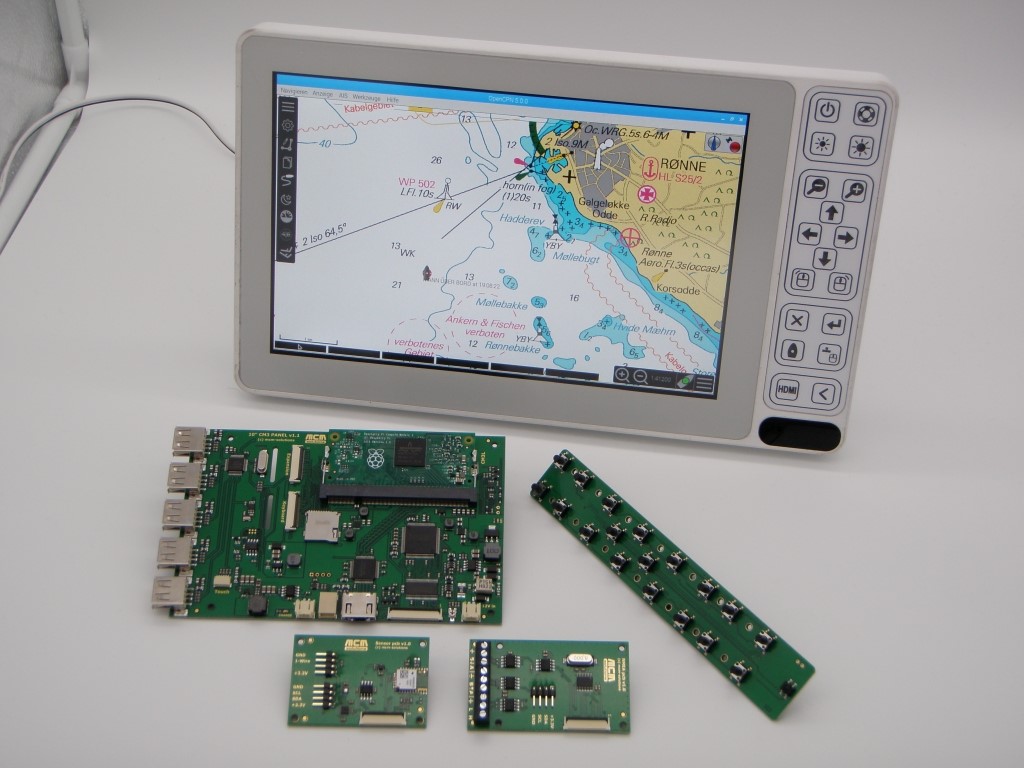
Fig. 10 ″ plotter with Raspberry Pi and OpenCPN
Christian presented his 10 ″ plotter based on Raspberry Pi at Boot 2020 in Düsseldorf. An attempt was made to create a marine-grade device that could be used to navigate a boat.
hardware
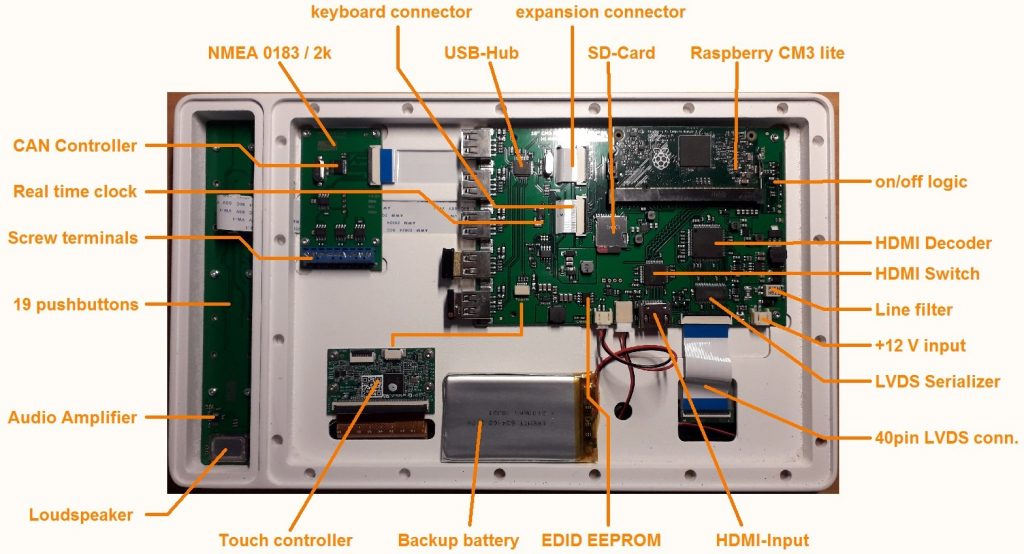
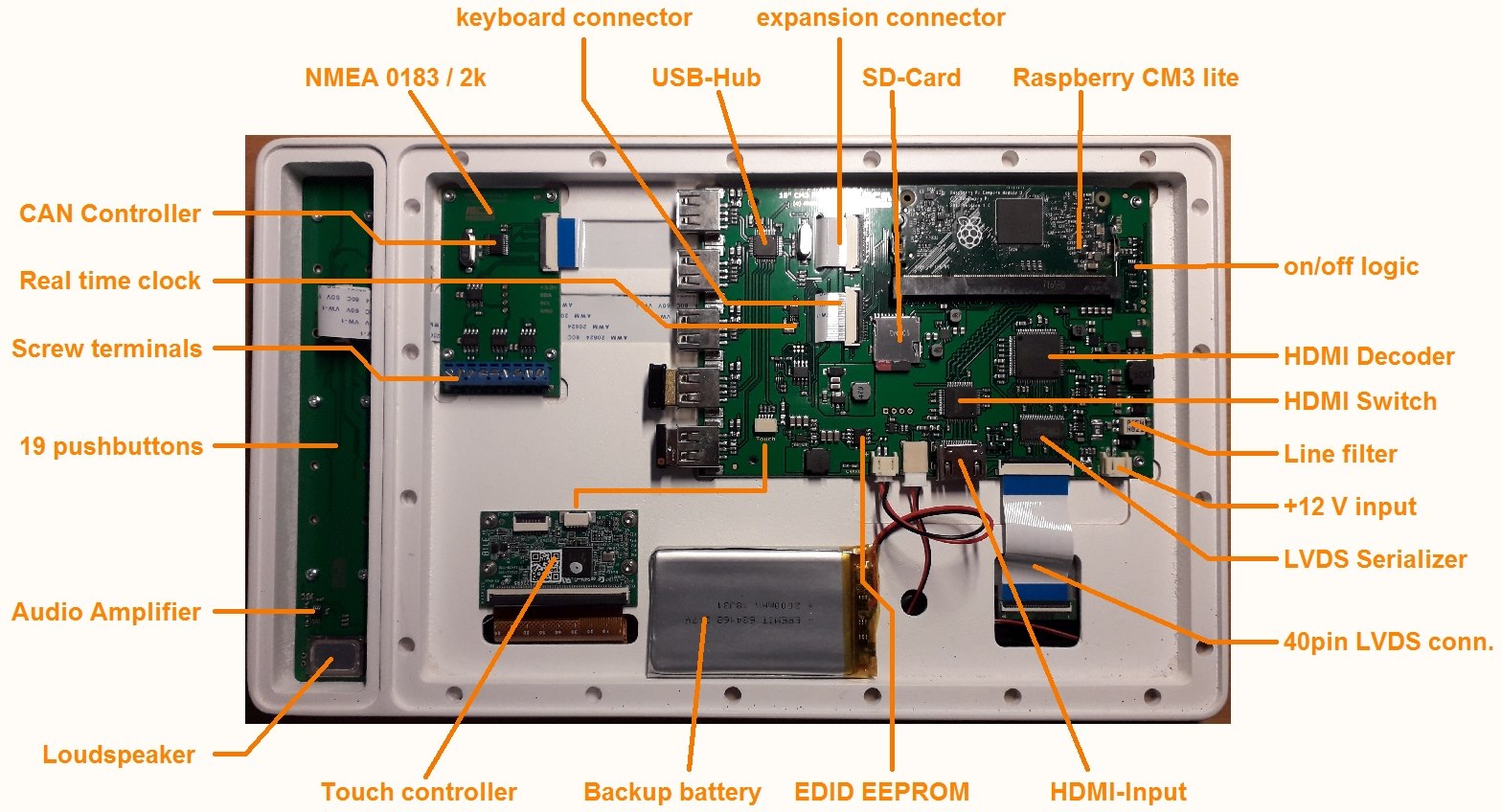
Fig. Components of the 10 ″ plotter
The CM3 light compute module was used as the central processing unit and a number of other necessary hardware components were housed on a base board.… Continue reading
First of all, a few important notes that you should definitely pay attention to.
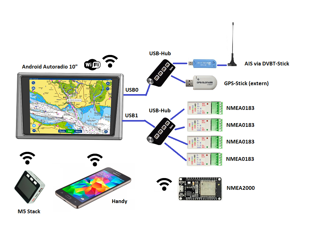
- Basis 2 DIN Android car radio
- Touch-capable 7” – 10” display, 1024 x 600 pixels, approx. 400 nits
- Touch function keys
- Cortex A7 QuadCore ARM processor, 1.2 GHz
- Depending on the model, Android 8, 9 or 10
- Depending on the model, 1… 4 GB RAM
- 16/32 GB ROM depending on the model
- Powerful wired GPS included
- Bluetooth, WiFi 802.11b / g / n, 2.4 GHz
- Integrated CAN bus (steering wheel remote control)
- 12V supply
- 10… 15 W in active operation
- 0.5 W in standby
- 3 s wake-up time from standby
- 2x USB 2.0 (ext.
...
Continue reading
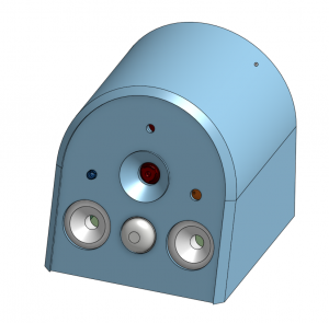
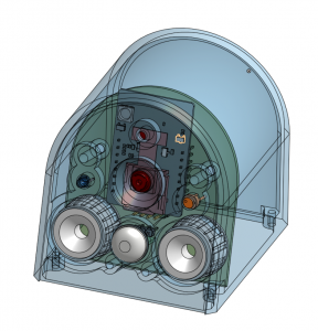
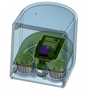

https://www.segeln-forum.de/thread/72312-abstandssensor-diy/?pageNo=1
- Project started in 06/2019
- Project start as an ultrasonic distance sensor with two front sensors
- ESP8266 as an evaluation unit with WLAN
- 12V / 80mA
After some discussions in the forum, the idea came up to use a camera that is installed at spreader height and looks at the foredeck. There are already commercial products such as the CAM100 from Raymarine, but it costs around EUR 700 and can only be integrated into their plotter.… Continue reading
First of all, a few important notes that you should definitely pay attention to.
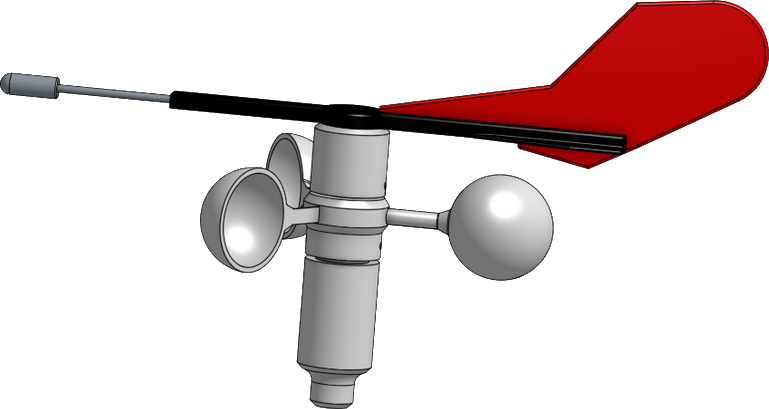
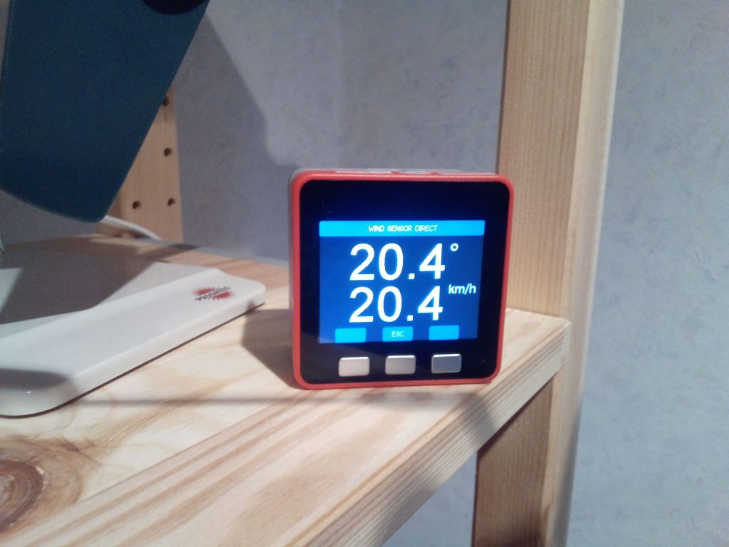
- Measurement of wind direction and wind speed
- Robust mechanics
- Weight <= 250g
- Small enough to be grown on a 6.60m sailboat
- Replacement for a Windex
- Weatherproof and UV-stable
- Visibility at night thanks to reflectors on the bottom
- No cable laying for sensor signals
- Pure digital transmission and signal processing
- 12V power supply via toplight (50mA, 0.5W)
- Transfer of data via WLAN (ESP8266)
- Update rate: 1-2 measurements per second
- No installation instrument required
- Display in OpenPlotter via laptop, mobile phone or tablet
- No software installation required (displayed on the website in the browser)
- Android app available
- Support of common protocols such as NMEA 0183 (serial, TCP / IP)
- More than 30 systems have already been built and in use
https://www.segeln-forum.de/thread/67401-windsensor-diy/?pageNo=1... Continue reading
THE free and open source chart plotter: opencpn.org

- numerous chart formats supported
- individual user interface
- AIS collision alert
- integration of weather and current gribs
- NMEA0183 interface (SignalK support under development)
- tactics plugIn
- …
Official vector charts (iENCs) are available free of charge for inland waterways in Europe and the USA. Offshore charts (oeENCs) made available via o-charts.org to be acquired.… Continue reading
 The database of the OpenStreetMap's database contains a lot of geoinformation, which is quite useful for planning a boat trip.
OpenNauticalChart creates a seamark-overlay from this data, OpenSeaMap makes this available online. Chart packages are also available for download, here.
A wide variety of chart styles and applications have been developed around this idea. Especially the Inland Navigator all the necessary information about bridge heights, lock times and even route planning throughout Europe is available.… Continue reading