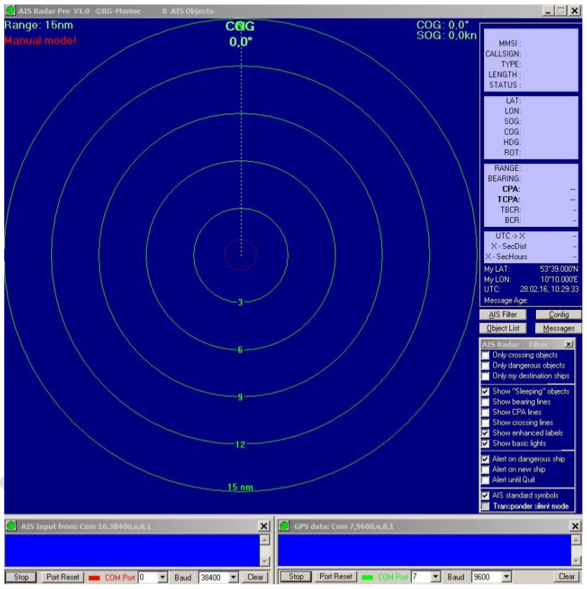
AIS Radar Pro receives the AIS messages from the connected AIS receiver (receiver), decodes the information it contains and displays it graphically and in text form. From the position and speed data obtained, AIS radar determines possible opponents in the collision, the distance in nautical miles and minutes to the closest approach to the opponent in the collision, as well as the location and time of a possible collision. AIS Radar Pro follows the simple RG Marine principle: Everything that lights up RED is dangerous. With a glance at the "AIS Radar Pro" monitor, the navigator can see which AIS objects (ships) represent potential sources of collision and take measures to prevent collisions in good time.
This is what the AIS Radar Pro software does:
- Display of all received AIS objects in VHF range
- Automatic calculation of distance and bearing to the object
- Automatic calculation of the closest approximation (CPA, TCPA)
- Warning of possible collision opponents (red symbol and course line)
- Display of the time and place of the possible collision
- Display of safety distance and time when crossing the opponent's keel line
- Display of all received object information (ship data)
- Display of the light guidance (Basic Lights)
- Filter to hide sleeping or harmless objects
- Warning of ships that are not visible at the current zoom level
- Audible alarm for new and / or dangerous ships
- Automatic deletion after an adjustable time interval (no more reception)
- Zoom range from 0.5 to 120 nautical miles
- AIS monitor can be enlarged up to full screen size
- Line widths, colors and background image can be selected
- Automatic storage of ship data for quick identification
- The own ship is always centered (as with radar)
- COG UP or North UP representation
- Manual entry of position if no GPS signal is available
- Control window of the received AIS and GPS data (NMEA messages)
- Sorting of the object list according to selectable criteria (e.g. distance to the object)
- AIS Radar Pro is IP network compatible. Several PCs can be connected.
- Interface to GOOGLE Earth
The software AIS Radar Pro can be installed and used under Win7 to Win10 for non-commercial purposes. A Online documentation is located here. There is also detailed documentation in PDF form that is included in the software's zip file.
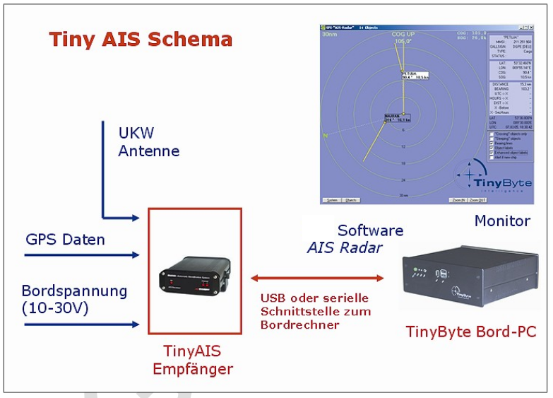
Fig .: Data scheme
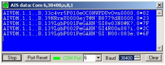
Fig .: NMEA data stream via serial interfaces
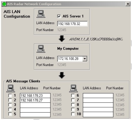
Fig .: Distribution of AIS information in the IP network to various computers