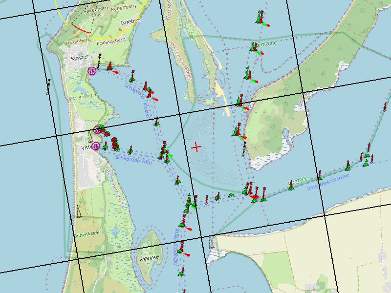
Fig.: Created map sections with location, rotation and grid
The Maps Converter is a server service from Open Boat Projects for converting nautical charts into various resolutions and image formats. This allows relatively simple microcontroller-based navigation devices to be created with various display types. Both color and black-and-white displays are supported.
The microcontroller sends an HTTP GET request to the server, specifying the geocoordinates, direction of travel, image size, and image type. The server then transmits the fully rendered image to the microcontroller. The microcontroller queries various map services and combines the individual tiles and navigation marker layers into a single image, rotates the image in the desired direction, and outputs it in the desired size and color. The image is output as a PNG image or as a black-and-white binary image in JSON. The microcontroller then only needs to display the received image on the screen and is freed from any image processing functions.

Video: OBP60 with ESP32-S3 and nautical chart (data source Maps Converter)
Example code for the OBP60 and OBP40: https://github.com/norbert-walter/obp60-navigation-map
Further details about the Map Converter can be found in the GitHub project: https://github.com/norbert-walter/maps-converter